|
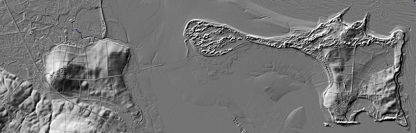
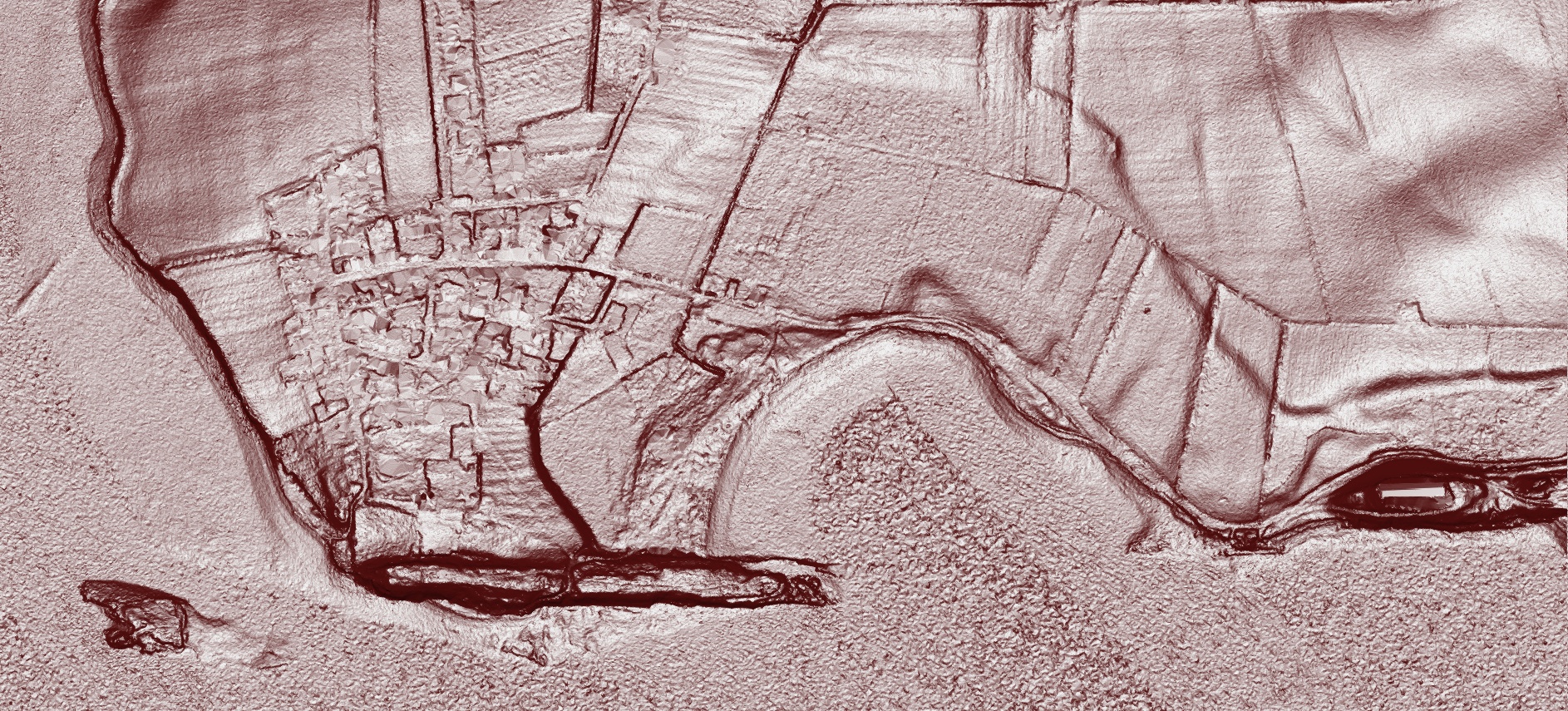
Above Island image from houseprices.io DSM (Digital Surface Model) rendering
|
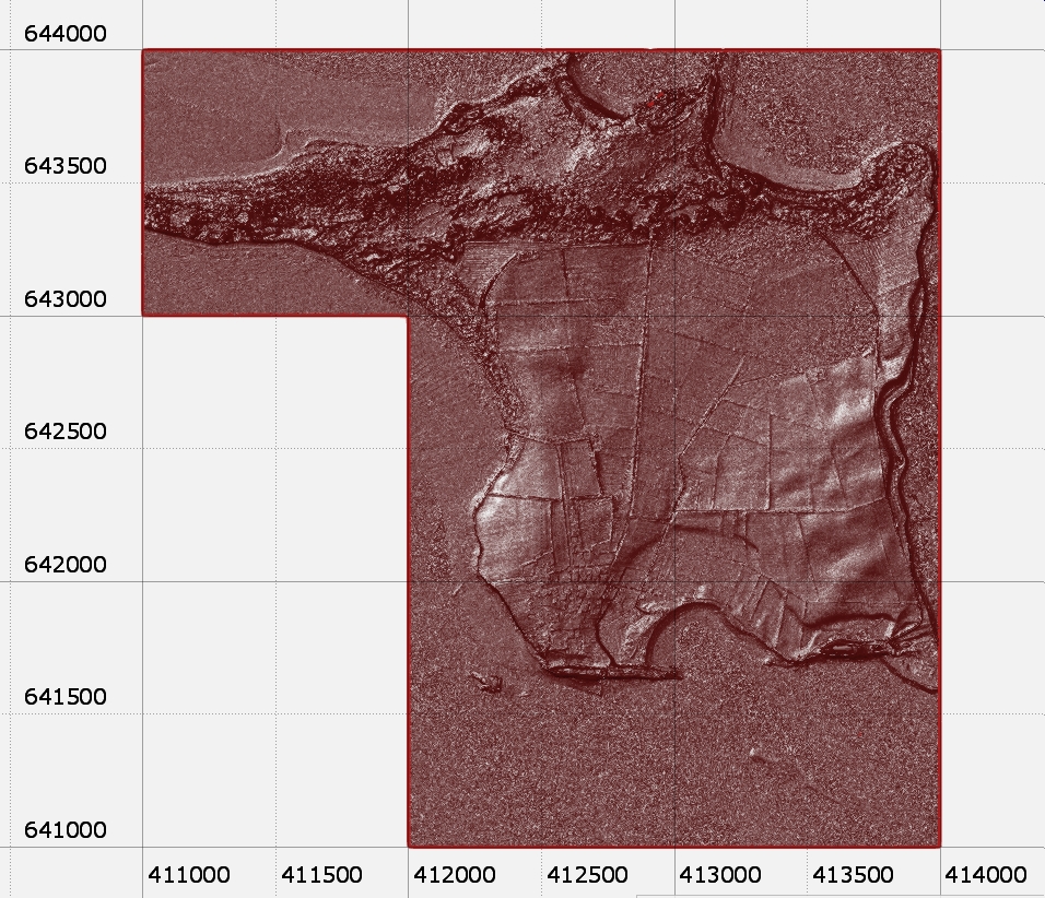
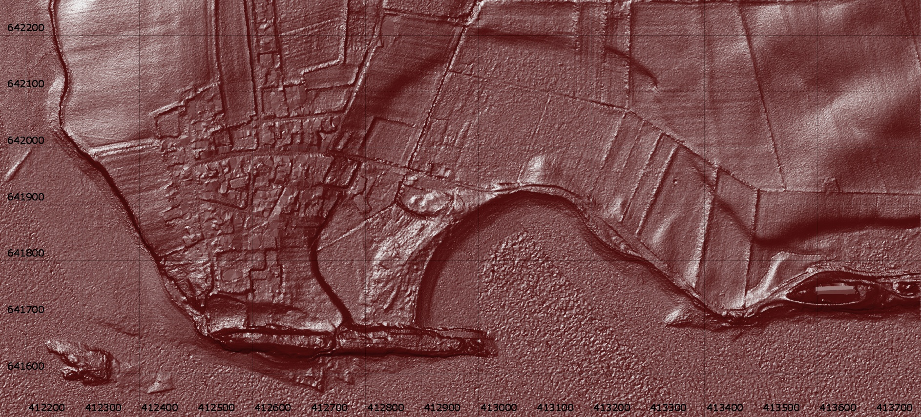
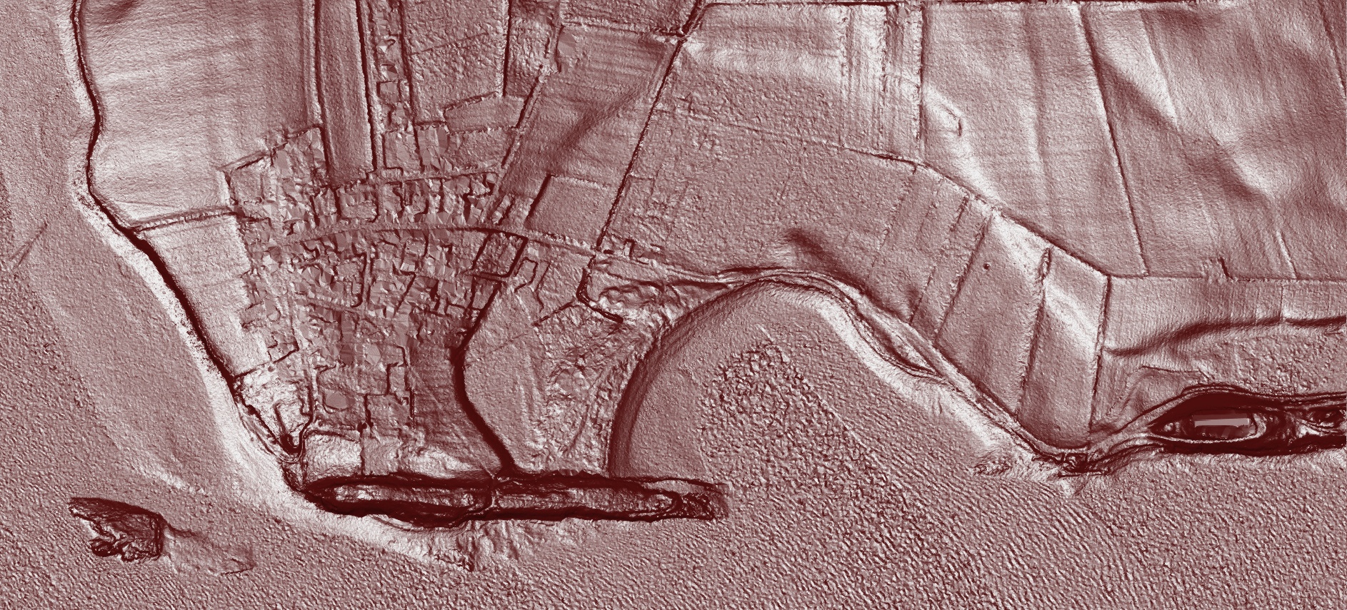
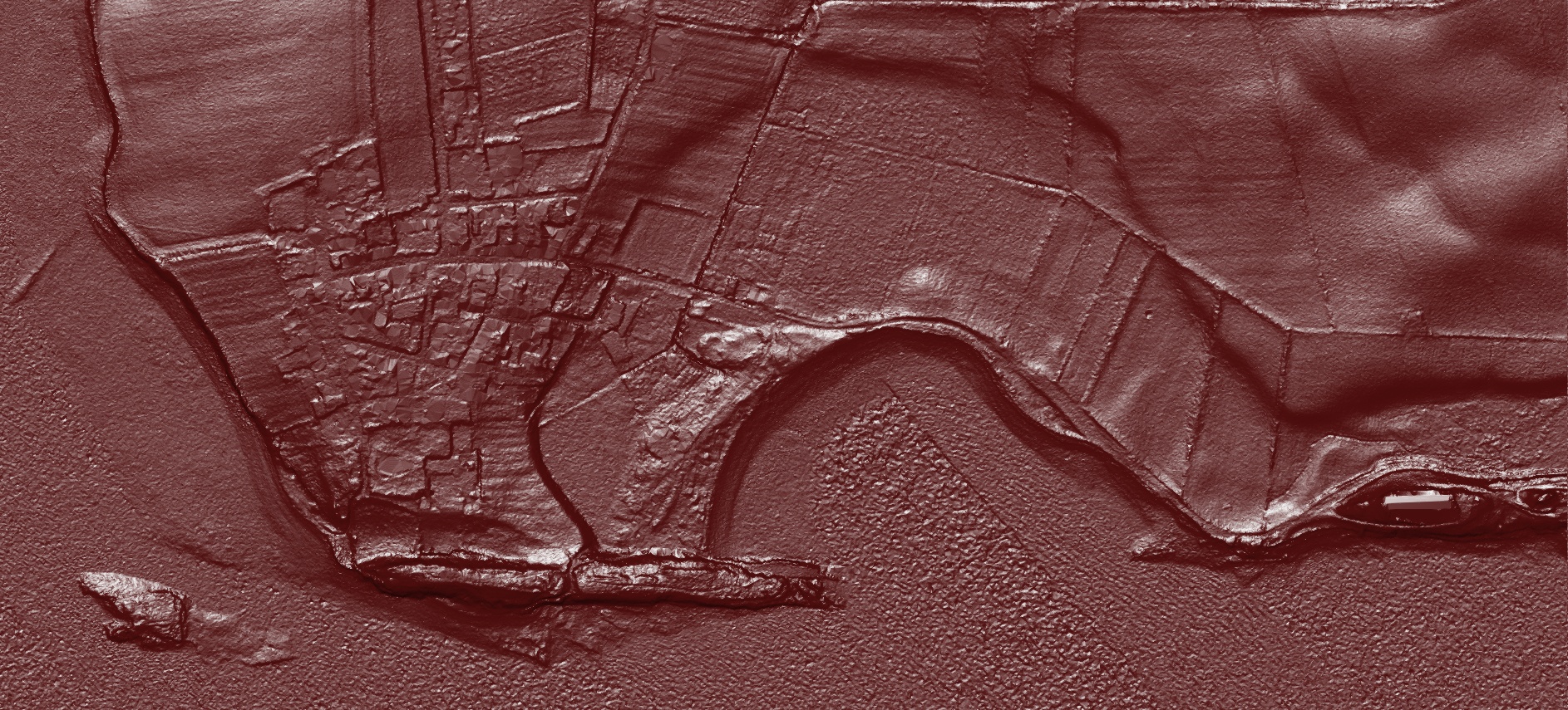
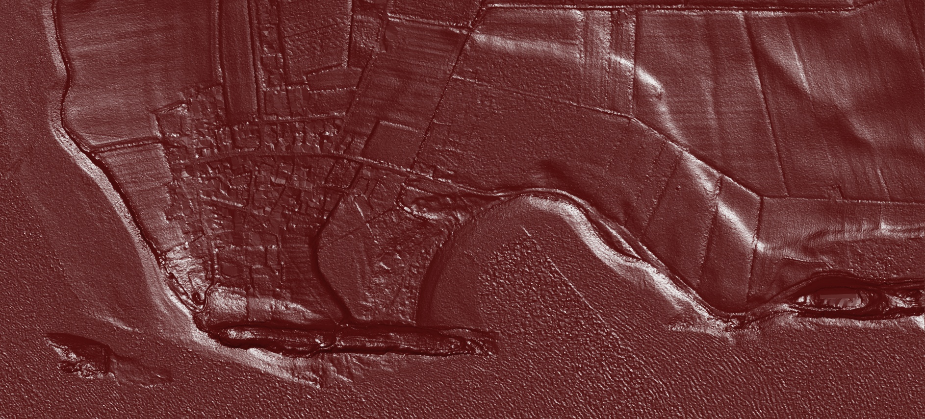
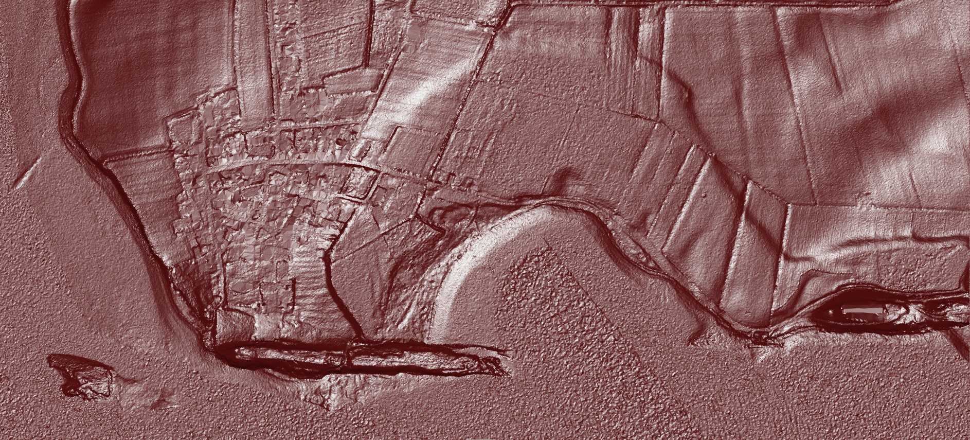
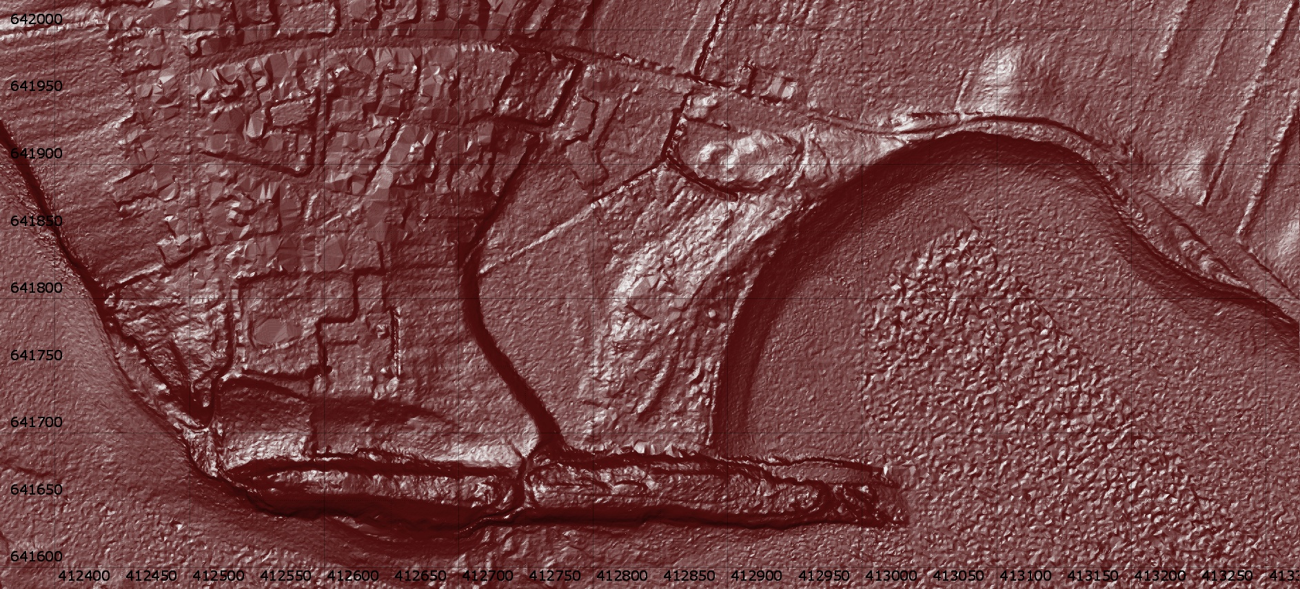
These are various Lidar derived images of the southern part of Lindisfarne and use 'pseudo' illumination from differing directions to highlight the 'lumps and 'bumps'.
The images are derived from the publically available Environment Agency Lidar data, in this case the 1m resolution 'Digital Terrain Model' (DTM) data which removes trees and buildings (Buildings are the flat rectangular structures in the images)
Click on an image to view it in its own page
|
Lidar overview of the majority of the island, The axes are OS Grid references
|
|
Scrollable and zoomable location map, courtesy of Bing
|
|
|
|
|
|
|
|
|
|
|
|
|
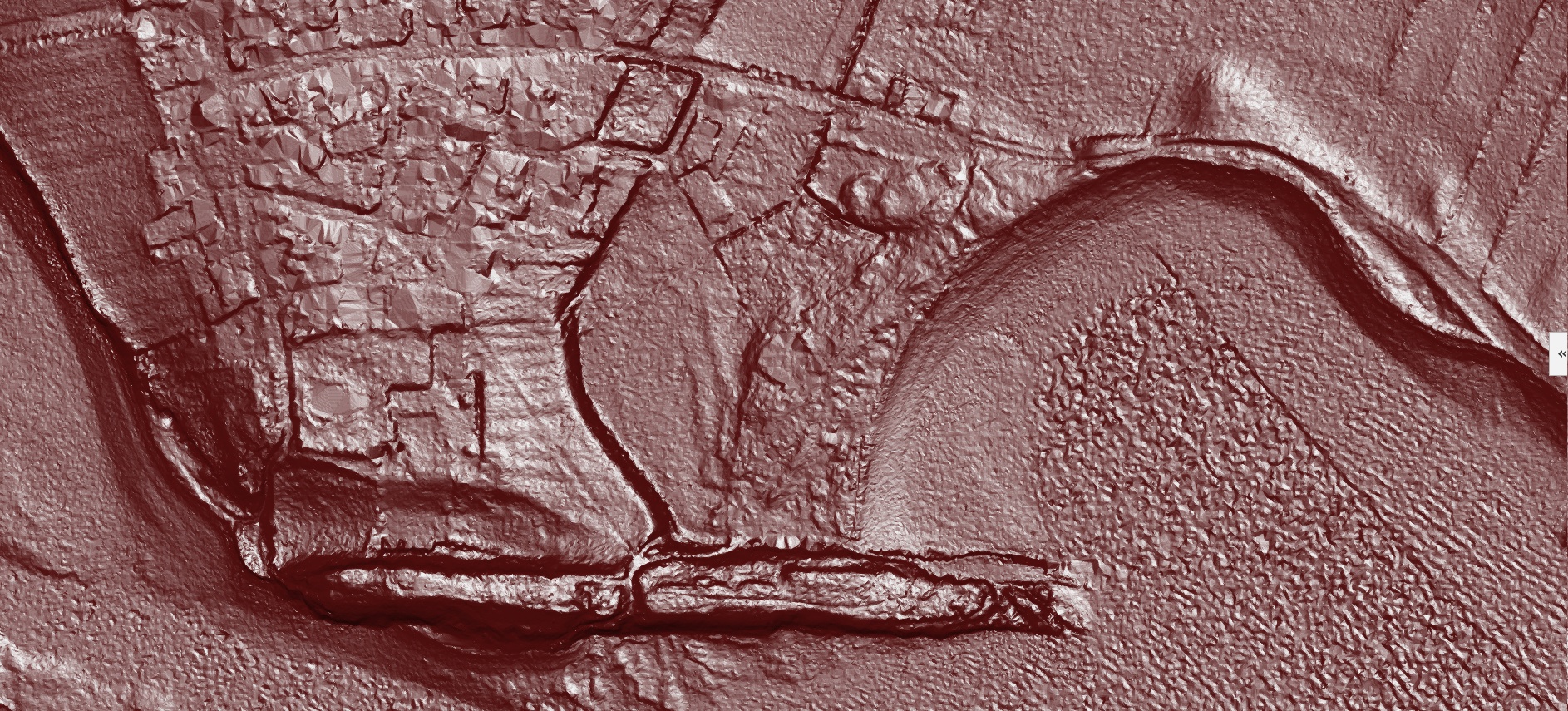
Enlarged Abbey area
|
|
|
| The Lidar data is publically available Environment agency 1m DTM Lidar Datasets. Processed by Phil Barrett. |
© The Friends of Castleshaw Roman Forts , 2018
www.castleshawarchaeology.co.uk
www.castleshawarchaeology.co.uk