| Home |
|
Lidar
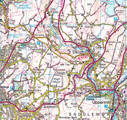
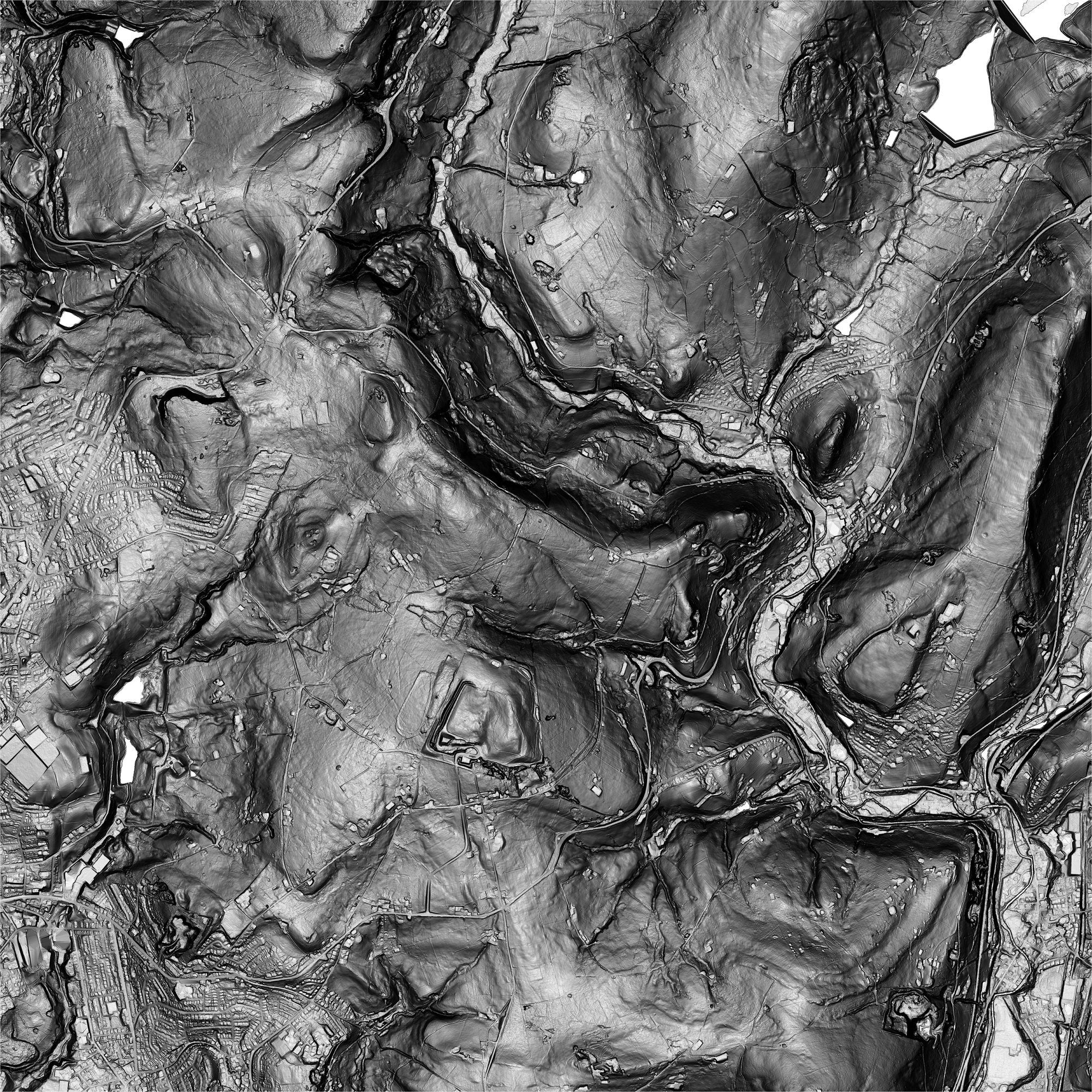
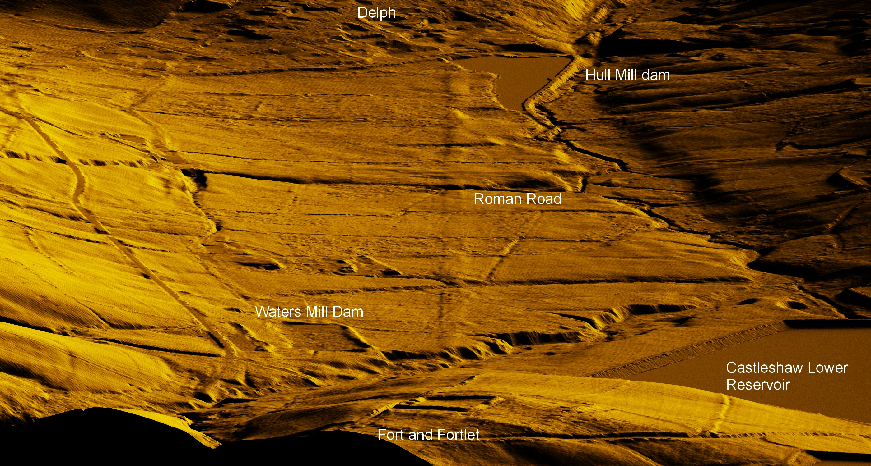
of the Castleshaw Valley and environs Data from the Environment Agency National Lidar Program (Digital Terrain Model data, buildings/trees removed) 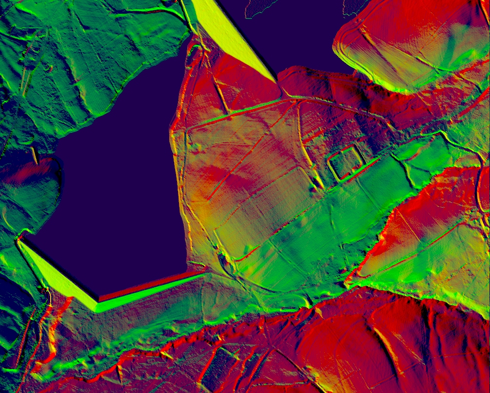 Many of the following Lidar images are large (up to 27MB), especially the 5km x 5km ones and open in their own windows from where they can be downloaded/zoomed/saved. 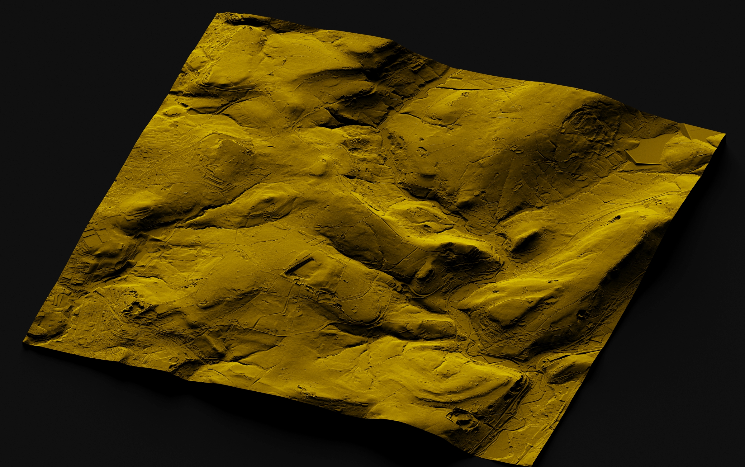 3D Lidar Model of the 5km x 5km map below. The Roman Road can be seen emerging from Austerlands (lower left, you will need to zoom in) and traversing the landscape to Castleshaw (Top right) The quarry at High Moor is prominent in the centre, with Knott hill to its right directly above Delph village. The Castleshaw valley runs from Delph towards the top right (and the Castleshaw reservoirs). Click the image above to examine in detail. Click here for an annotated image showing the road. | ||||||
A 3D LiDAR Flyaround of the Fort area at Castleshaw. Click to play/pause or expand. Click the images for a full screen view
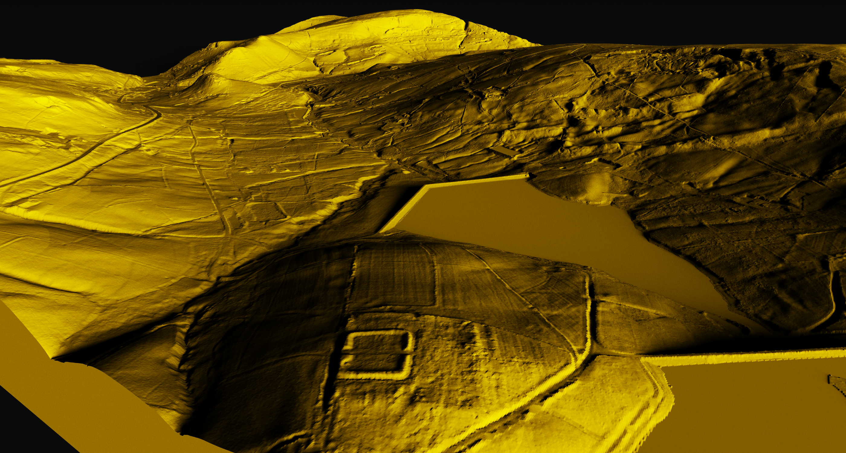
3D Lidar Model Images. Click the images for a full screen view
Lidar derived 20cm contour map of the Forts area. Waters Clough Monastic site. 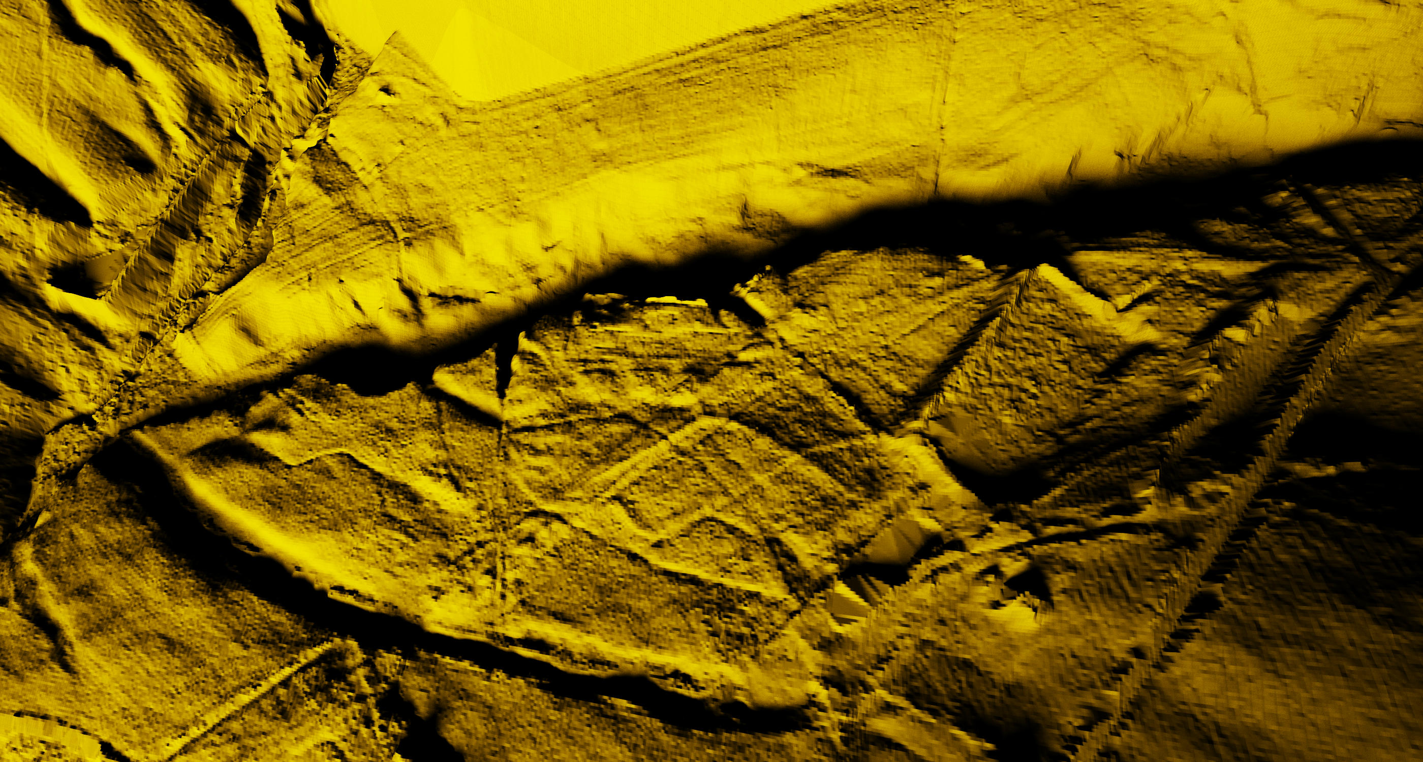 3D Lidar view Waters Clough area (with 5x vertical exaggeration, the 'vast chasm' crossing the image is the Waters Clough brook)
|


Images/Data processing by
Phil Barrett, Data (GeoTiffs) from the Environment Agency Geomatics
group
Data available under the Open Government licence v3.0
© The Friends of Castleshaw Roman Forts , 2020
www.castleshawarchaeology.co.uk
Data available under the Open Government licence v3.0
© The Friends of Castleshaw Roman Forts , 2020
www.castleshawarchaeology.co.uk