|
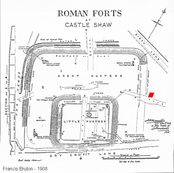
Castleshaw Roman Fort -
Resistance survey around
the eastern gate - 24th June 2017
During the dig at Castleshaw fort in July 2014 an
unexpected stone paved area was found just outside the
east gate and apparently heading north.
This is the area shown below in red.
|
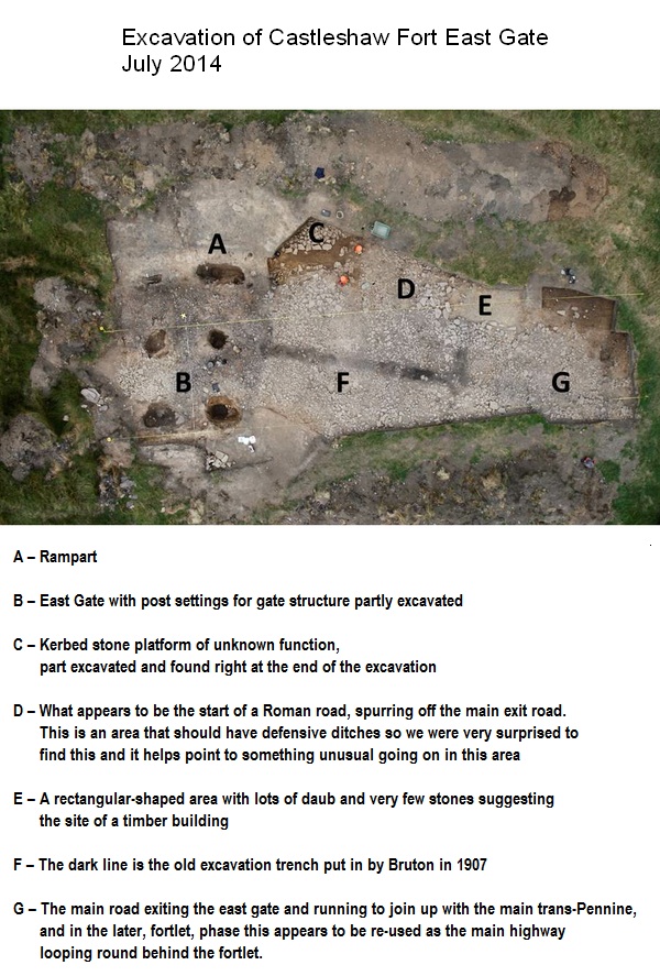
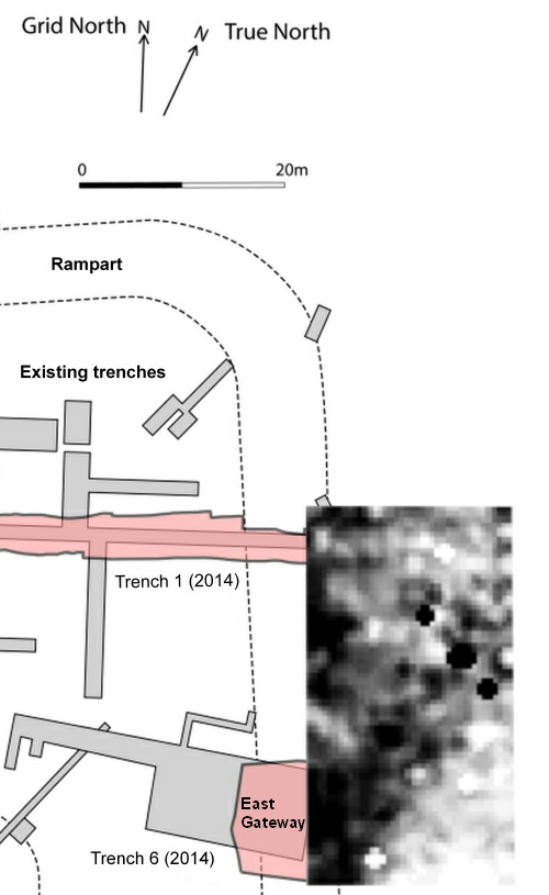
This is an aerial view of the excavation of
the East gate from 2014 and shows a number of
interesting features as listed.
The east
gate was excavated originally in 1907 by Francis
Bruton as part of the first large scale
excavations of the Fort and Fortlet and was the
source of the overview map I have used above
from his 1908 book on the Forts.
His
trenches being clearly visible at 'F'.
It
was the discovery of the apparent start of the
road at 'D' which sparked our interest in the
possabilities of a new road.
|
It was decided that a geophysical survey using the
friends resistance meter would be a worthwhile exercise
to see if this spur did indeed become a road and in
which direction it went (was it just an exterior road
around the fort?)
|
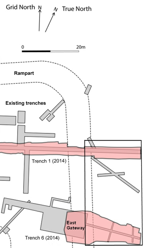
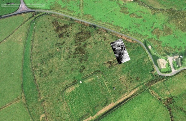
On the 24th june 2017, as part of the Greater
Manchester Archaeology Festival and in
conjunction with test pitting outside the
northern defences of the fort we surveyed the
area indicated left.
The area includes
the outer part of the eastern gateway and the
area to the north of it.
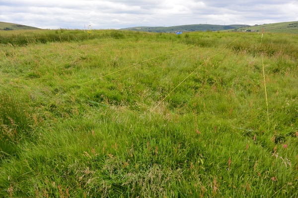
The photo above shows the area to be surveyed.
The fort gateway is about 1/3 of the way across from the
left on the near horizon (just about where the yellow
Resistivity meter is).
The area to be surveyed
contained a number of older trenches.
Trench 1
from the 2014 excavation traversed the north of the area
while trench 6 from 2014 crossed the southern area.
A couple of historical trenches of unknown
origin also crossed the area.
|
|
The resulting resistance survey appears to
show a road (darker = high resistance = harder
surface) heading directly from the gateway in a
northerly direction.
The more solid areas
of the rampart at the left also appearing darker
due to the compact materials.
The dark
crosses are merely a result of the computer
processing and are probabily single stones
encountered by the meter. (they should be
treated as a single 'high resistance' object).
Note that some of the previous known
trenches appear as lighter bands due to the less
compact infill.
There are possibly some
other 'anomalies' (unknown trenches maybe)
appearing as lighter bands across the area.
|
This is the Resistivity survey results overlaid on an
aerial photo and shows the dark (high resistance) band
leaving the eastern gateway heading north.
The eastern gateway in this image has a covering of
rushes due to the slight depression in the land
accumulating water.
Note: A number of historical trenches
across the site can be seen (plus the layout of the
fortlet buildings highlighted after previous
excavations).
The survey was performed by Phil Barrett and Jane
Neild of the Friends of Castleshaw Roman Forts using an
R M Frobisher TAR-3 Resistance meter.
The grid was a
36m x 20m grid and readings were taken each metre.
|