Lidar Images of Epiacum Roman Fort

Epiacum Lidar with Grid References
The numbers are OS Grid References


Epiacum (or Whitley Castle) is a fantastic Roman fort to the north of Alston in Cumbria famous for its multiple ditches and banks, and well worth a visit
https://www.epiacumheritage.org/

Epiacum's website contains a high resolution Lidar Image (https://www.epiacumheritage.org/research/) specially commisioned from English Heritage and should be viewed in conjunction with this slightly lower resolution Environmental Agency Lidar data.

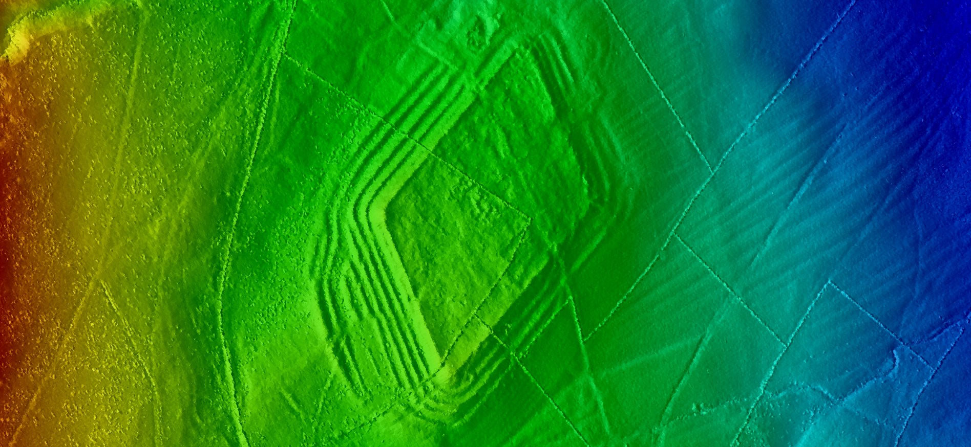
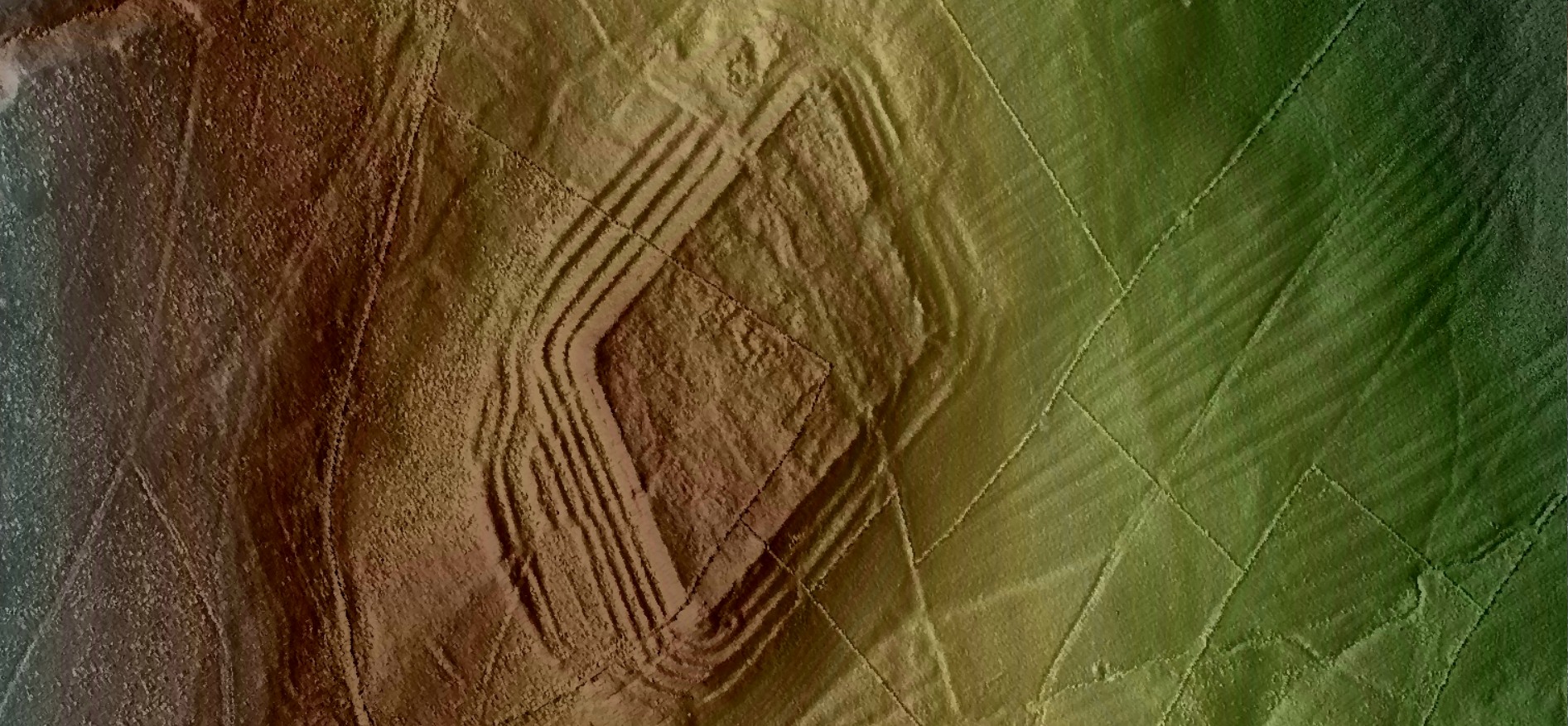
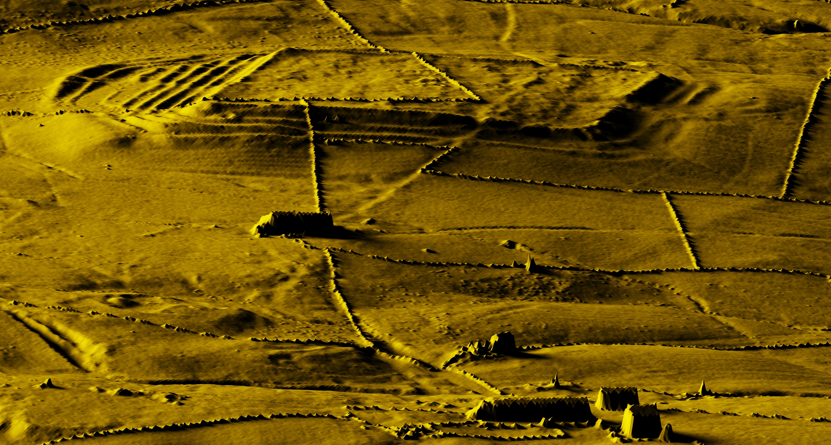
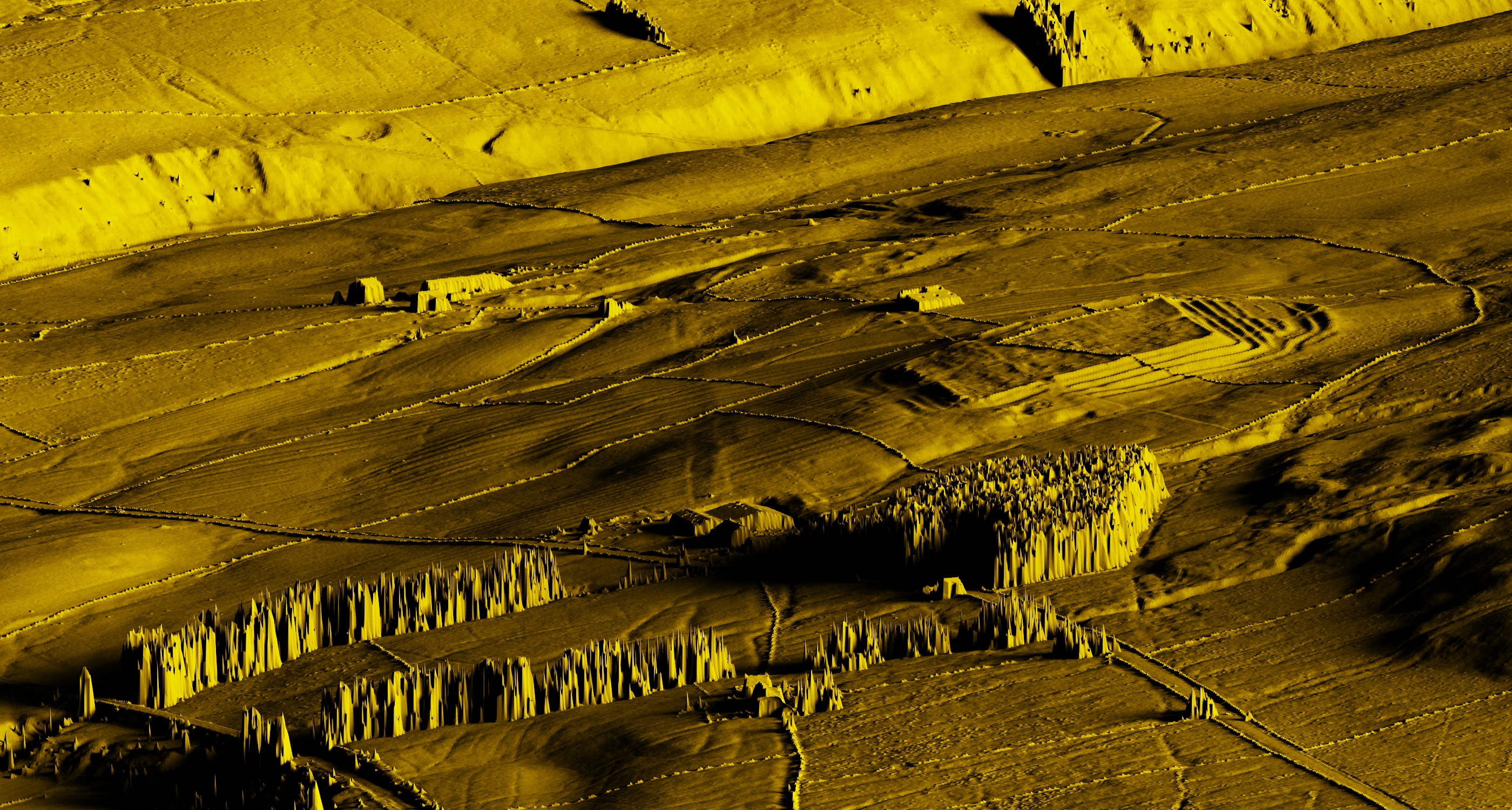
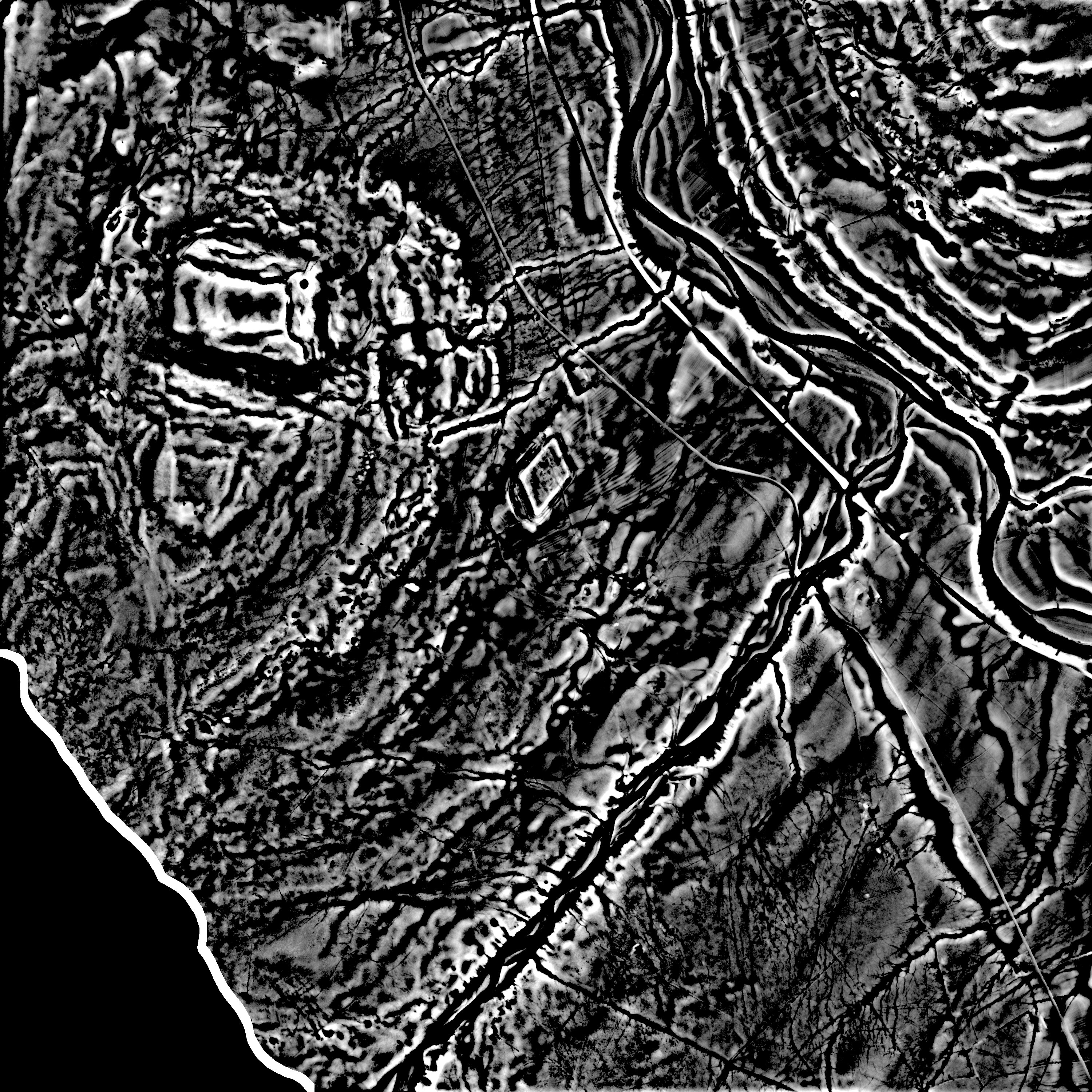
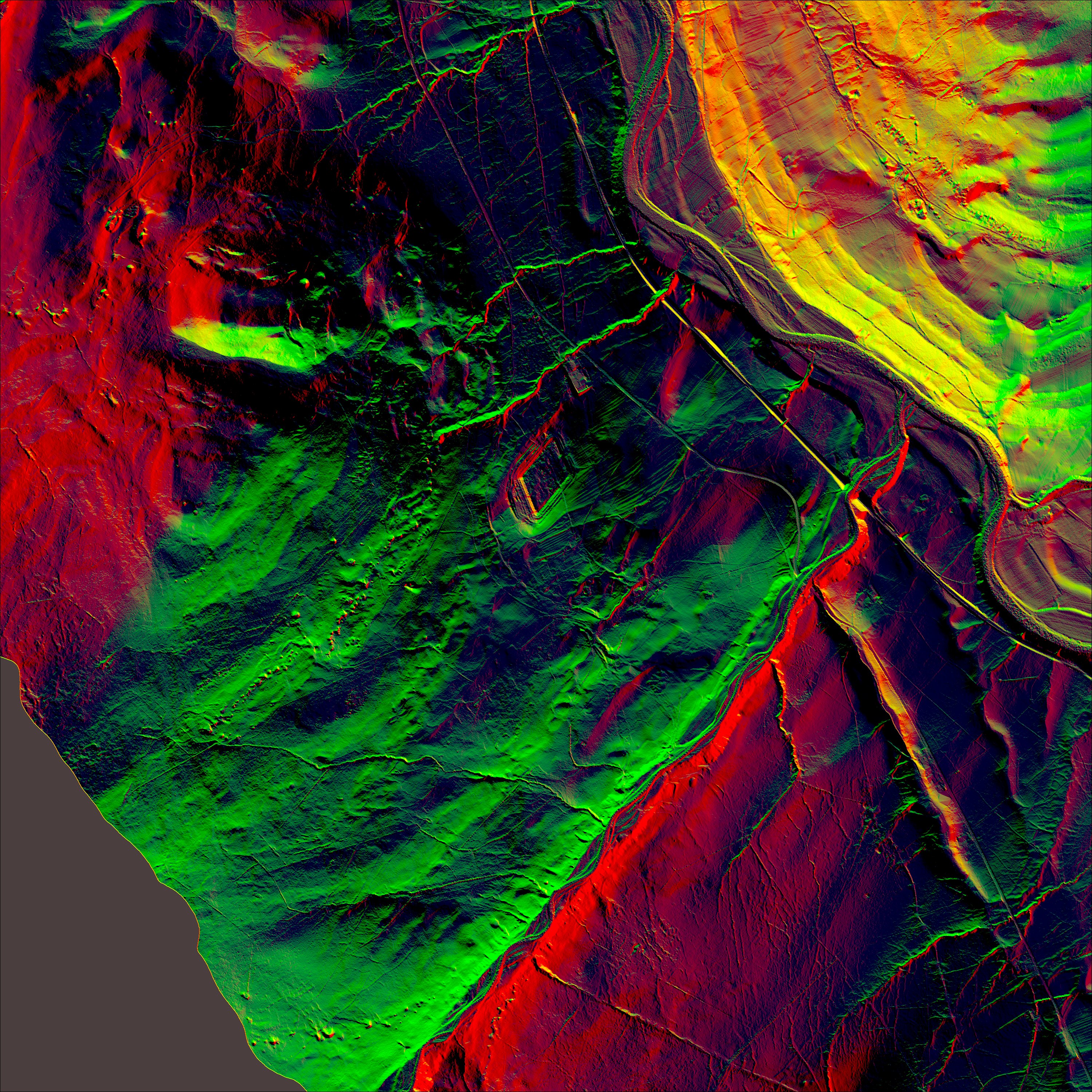
These are various Lidar derived images of Epiacum Roman fort  and use 'pseudo' illumination from differing directions to highlight the 'lumps and 'bumps'.

The images are derived from the publically available Environment Agency Lidar data, in this case the 1m resolution 'Digital Surface Model' (DSM) data showing all items in the landscape and the 1m resolution 'Digital Terrain Model' (DTM) data which removes trees, vegetation, field walls and buildings (Buildings are the flat rectangular structures in the images)
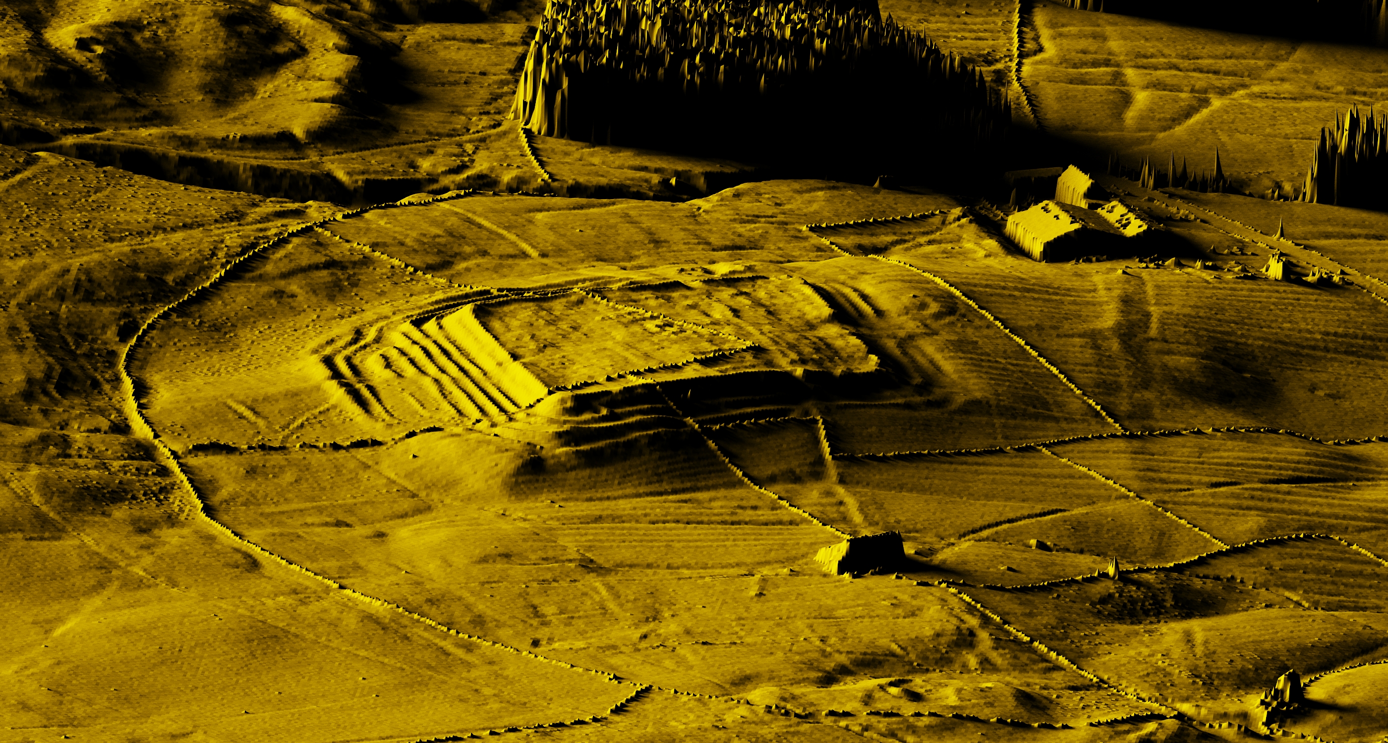
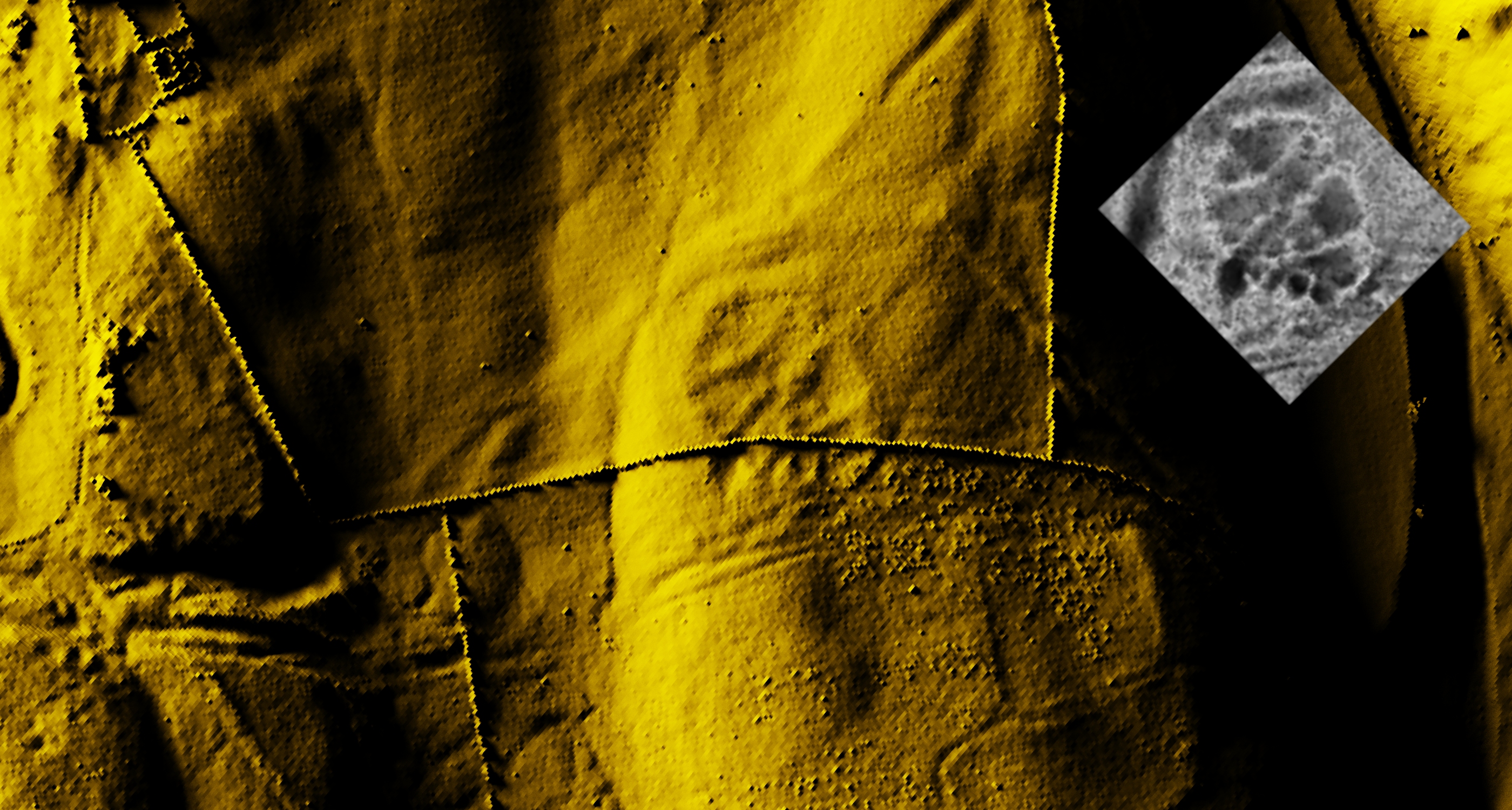
3d Lidar Model

Click on an image to view it in its own page


The western banks and ditches
The western ditches and banks, with Jane in the distance


Scrollable and zoomable location map, courtesy of Bing

Location:
Lat (WGS84) N54:49:56 (54.832284)
Long (WGS84) W2:28:34 (-2.476020)
Lat,Long 54.832284,-2.476020
Nat Grid NY695487 / NY6952048710


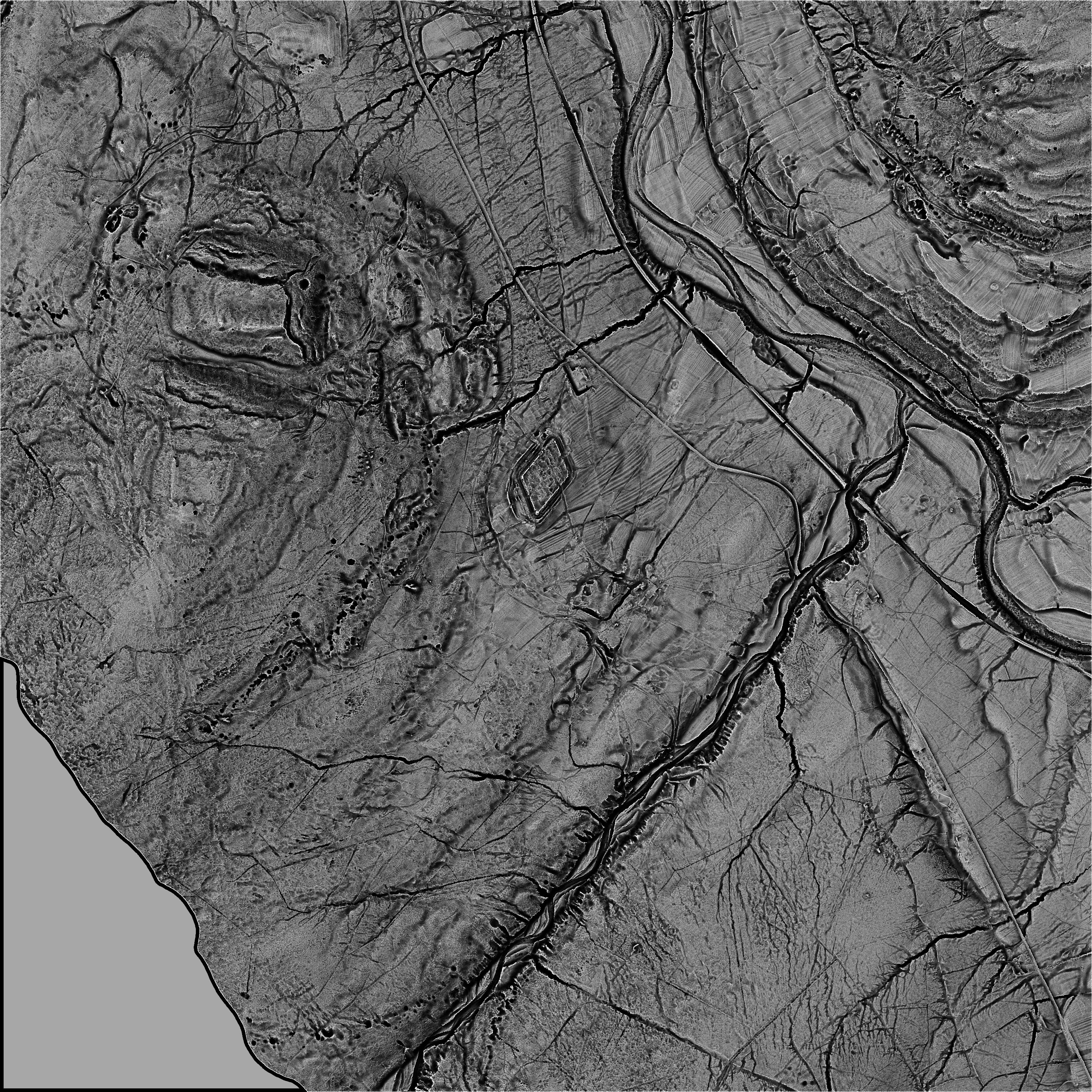
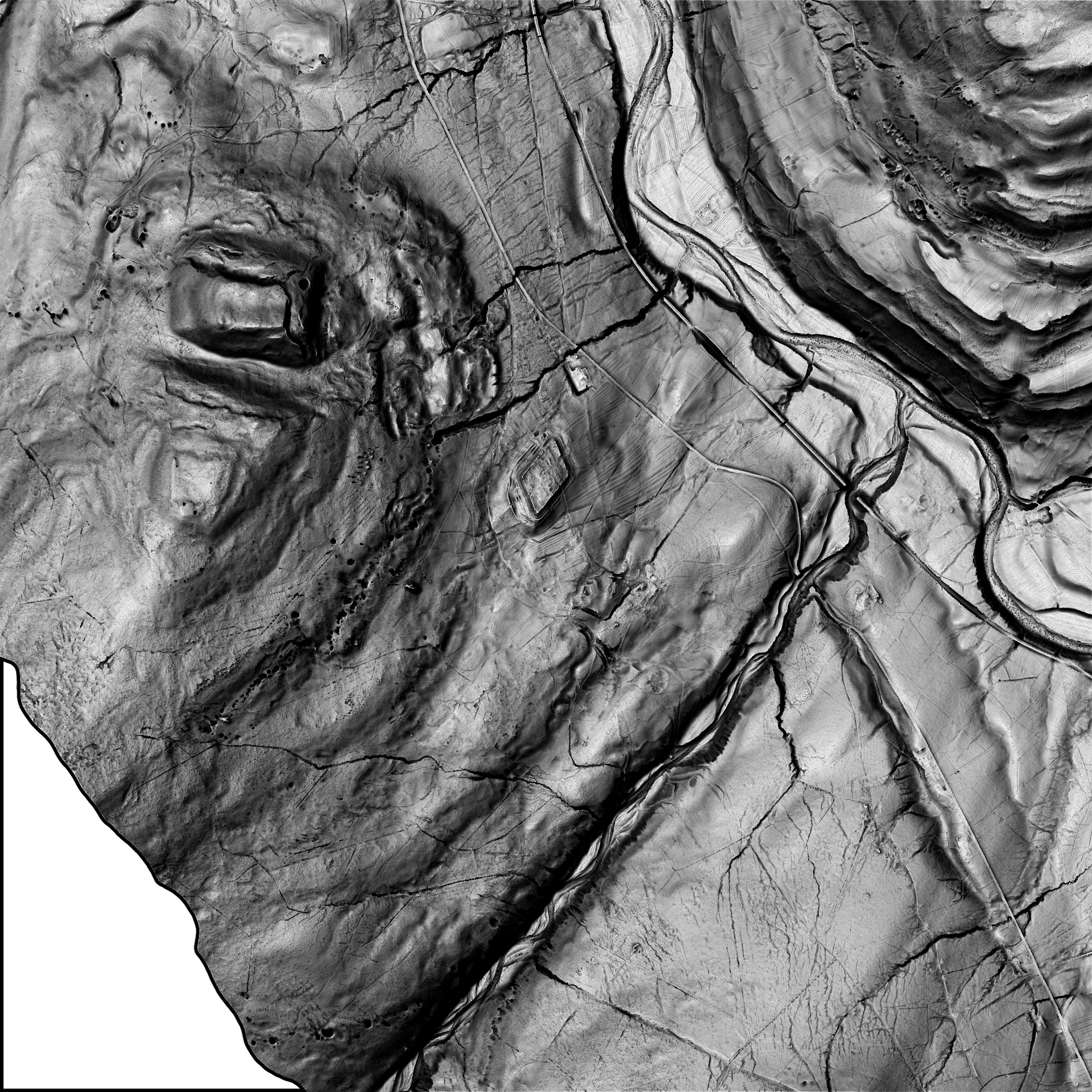
The following three images use the 'first pulse returned method' of processing  (If multiple Laser reflections are received back at the Aircraft due to trees, vegetation etc. then the first received pulse is used thus showing up the taller objects in the landscape).


Epiacum Lidar 2

Height: Blue (Low) to Red (High)

Epiacum Lidar 14


As Lidar is all about heights, then Lidar data can be easlly used to create contours.
The white contour crossing the fort just below centre is at 330m above sea level. The contours being at 2m intervals.

Epiacum Lidar 14contours


Oblique Lidar Looking north along the Maiden Way Roman Road under the farm. (Click for full size view)

Oblique Lidar


Oblique Lidar fort view from the south. (Click for full size view)

Oblique Lidar


Oblique Lidar Looking south along the Maiden Way Roman Road under the farm. (Click for full size view)

Oblique Lidar


The following images use the 'last pulse returned' method in an attempt to remove vegetation. Man made objects such as walls and buildings are also detected and removed. Unfortunately the odd low bank has also been removed, This appears to be due to some of the lidar reflections at these points being classed (incorrectly ?!) as 'Low' and 'Medium' vegetation.


Vertical 'Open Positive' Lidar Visualisation (Click for full size view)

Oblique Lidar


Vertical 'Sky View Factor' Lidar Visualisation (Click for full size view)

Oblique Lidar


Vertical 'Simple Local Relief Model' Lidar Visualisation (Click for full size view)

Oblique Lidar


Vertical 'Principle Component Analysis of Hillshading' Lidar Visualisation (Click for full size view)

Oblique Lidar

Epiacum Lidar 6


Vertical Close up Lidar of the Iron Age/Romano-British settlement at Gilderdale Burn, 600m SE of the fort (Click for full size view)
AltogetherArchaeology Geophysical Report

RB Settlement

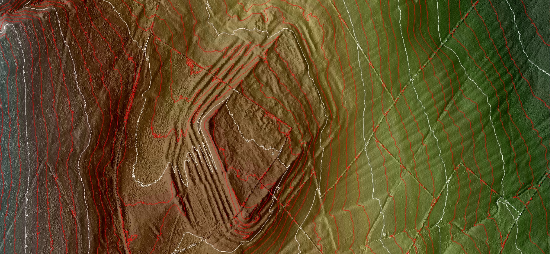
The Lidar data is publically available Environment agency 1m DTM and DSM Lidar Datasets.
Processed by Phil Barrett.


© The Friends of Castleshaw Roman Forts , 2020
www.castleshawarchaeology.co.uk